Democratic Underground Latest Greatest Lobby Journals Search Options Help Login
Google

Latest Models give a direct hit to New Orleans next week... again

Printer-friendly format Printer-friendly format
Printer-friendly format Email this thread to a friend
Printer-friendly format Bookmark this thread
This topic is archived.
Home » Discuss » Archives » General Discussion (Through 2005) Donate to DU
 
redsoxliberal Donating Member (1000+ posts) Send PM | Profile | Ignore Tue Sep-06-05 01:11 PM
Original message
Latest Models give a direct hit to New Orleans next week... again
now, due to katrina sucking much of the sst from the gom, it certainly wouldn't be a cat 4 or 5... probably just a weak hurricane... but it would possibly just completely destroy new orleans... I don't think it could deal with anymore water.

Luckily, this is nearly a week away, so plenty of time for change... and in all likelihood it will... just a heads up.

(Btw, this is the O storm... don't remember what the name is... TD16.)
Printer Friendly | Permalink |  | Top
whistle Donating Member (1000+ posts) Send PM | Profile | Ignore Tue Sep-06-05 01:12 PM
Response to Original message
1. Why, what is heading that way in storms
Printer Friendly | Permalink |  | Top
 
redsoxliberal Donating Member (1000+ posts) Send PM | Profile | Ignore Tue Sep-06-05 01:15 PM
Response to Reply #1
4. TD 16, soon to be the O storm


that is the ECMWF, the best model in the world... it probably won't happen... but if it doesn't drift north in the next 2 days (possible,) then a landfall close to New Orleans IS possible.
Printer Friendly | Permalink |  | Top
 
Nikki Stone 1 Donating Member (1000+ posts) Send PM | Profile | Ignore Tue Sep-06-05 01:18 PM
Response to Reply #4
11. Satellite link
Printer Friendly | Permalink |  | Top
 
Silverhair Donating Member (1000+ posts) Send PM | Profile | Ignore Tue Sep-06-05 03:26 PM
Response to Reply #11
76. What about all those clouds in the Gulf.
They look like they are trying to get organized. The waters are certainly warm enough to give a storm lots of fuel.
Printer Friendly | Permalink |  | Top
 
mccoyn Donating Member (512 posts) Send PM | Profile | Ignore Tue Sep-06-05 01:13 PM
Response to Original message
2. sst? gom?
Do you have more information on the model? What probability? What is it based on?
Printer Friendly | Permalink |  | Top
 
redsoxliberal Donating Member (1000+ posts) Send PM | Profile | Ignore Tue Sep-06-05 01:17 PM
Response to Reply #2
8. sea surface temps, gulf of mexico
European Centre for Medium-Range Weather Forecasts

and the GFDL and a couple other similar crap models support it... but the ECMWF is the BEST model in the world... that's not to say it's right, it probably isn't one week out... but it is a possibility.
Printer Friendly | Permalink |  | Top
 
mccoyn Donating Member (512 posts) Send PM | Profile | Ignore Tue Sep-06-05 01:21 PM
Response to Reply #8
18. Thanks. -nt
Printer Friendly | Permalink |  | Top
 
GOPisEvil Donating Member (1000+ posts) Send PM | Profile | Ignore Tue Sep-06-05 01:13 PM
Response to Original message
3. Ophelia.
:(
Printer Friendly | Permalink |  | Top
 
soothsayer Donating Member (1000+ posts) Send PM | Profile | Ignore Tue Sep-06-05 01:26 PM
Response to Reply #3
23. Ophelia just goes crazy and drowns herself. Wait...that's
Shakespeare.
Printer Friendly | Permalink |  | Top
 
TahitiNut Donating Member (1000+ posts) Send PM | Profile | Ignore Tue Sep-06-05 02:20 PM
Response to Reply #3
71. Quick! Send out for Danish!
Edited on Tue Sep-06-05 02:22 PM by TahitiNut
:evilgrin:
Printer Friendly | Permalink |  | Top
 
Taxloss Donating Member (1000+ posts) Send PM | Profile | Ignore Tue Sep-06-05 03:01 PM
Response to Reply #3
73. Appropriate. As Hamlet says to the players:
"Speak the speech, I pray you, as I pronounced it to you - trippingly on the tongue; but if you mouth it, as many of your players do, I had as lief the town-crier had spoke my lines. Nor do not saw the air too much your hand, thus, but use all gently; for in the very torrent, tempest, and as I may say the whirlwind of your passion, you must acquire and beget a temperance that may give it smoothness. O, it offends me to the soul to hear a robustious, periwig-pated fellow tear a passion to tatters, to very rags, to split the ears of the groundlings, for the most part are capable of nothing but inexplicable dumb shows and noise...
Printer Friendly | Permalink |  | Top
 
yy4me Donating Member (1000+ posts) Send PM | Profile | Ignore Tue Sep-06-05 01:16 PM
Response to Original message
5. Somebody tell Brown just so he can keep up the good work
n/t
Printer Friendly | Permalink |  | Top
 
SammyWinstonJack Donating Member (1000+ posts) Send PM | Profile | Ignore Tue Sep-06-05 01:19 PM
Response to Reply #5
12. That's Brownie to you.
:silly:
Printer Friendly | Permalink |  | Top
 
Shadder Donating Member (1000+ posts) Send PM | Profile | Ignore Tue Sep-06-05 01:16 PM
Response to Original message
6. Different track
The track that I'm seeing has it coming in just south of Jacksonville on Saturday.
Printer Friendly | Permalink |  | Top
 
mtnester Donating Member (1000+ posts) Send PM | Profile | Ignore Tue Sep-06-05 01:18 PM
Response to Reply #6
10. I think that one is named storm Nate
this is for the next one that has not been named yet but is developing?

Am I off base on this?
Printer Friendly | Permalink |  | Top
 
redsoxliberal Donating Member (1000+ posts) Send PM | Profile | Ignore Tue Sep-06-05 01:19 PM
Response to Reply #10
13. no im pretty sure the NHC has it there, and Nate not affecting land
Printer Friendly | Permalink |  | Top
 
KamaAina Donating Member (1000+ posts) Send PM | Profile | Ignore Tue Sep-06-05 01:33 PM
Response to Reply #10
31. Nate is in the Atlantic and may just about center Bermuda
as a hurricane :scared: Bear in mind that on an island (like Kaua'i in 'Iniki, Sept. 11 (!), 1992) there's really no place to evacuate to.

http://www.nhc.noaa.gov/storm_graphics/AT15/refresh/AL1505W_sm2+gif/145441W_sm.gif
Printer Friendly | Permalink |  | Top
 
leftofthedial Donating Member (1000+ posts) Send PM | Profile | Ignore Tue Sep-06-05 01:17 PM
Response to Original message
7. here's hoping the bushturd is there posing with some imported dark-skinned
people when it hits.
Printer Friendly | Permalink |  | Top
 
Nikki Stone 1 Donating Member (1000+ posts) Send PM | Profile | Ignore Tue Sep-06-05 01:17 PM
Response to Original message
9. MAp
Printer Friendly | Permalink |  | Top
 
welshTerrier2 Donating Member (1000+ posts) Send PM | Profile | Ignore Tue Sep-06-05 01:22 PM
Response to Reply #9
20. good debunking research ...
thanks, nikki ...
Printer Friendly | Permalink |  | Top
 
Nikki Stone 1 Donating Member (1000+ posts) Send PM | Profile | Ignore Tue Sep-06-05 01:42 PM
Response to Reply #20
42. De nada, WT. :)
:)
Printer Friendly | Permalink |  | Top
 
welshTerrier2 Donating Member (1000+ posts) Send PM | Profile | Ignore Tue Sep-06-05 01:19 PM
Response to Original message
14. let's be careful with threads like this ...
Edited on Tue Sep-06-05 01:20 PM by welshTerrier2
i'm seeing a projection of TD16 moving north along Florida's EAST COAST ...

source: http://www.weatherunderground.com/tropical/tracking/at200516_5day.html

Printer Friendly | Permalink |  | Top
 
Nikki Stone 1 Donating Member (1000+ posts) Send PM | Profile | Ignore Tue Sep-06-05 01:20 PM
Response to Reply #14
17. yes
Printer Friendly | Permalink |  | Top
 
demo dutch Donating Member (1000+ posts) Send PM | Profile | Ignore Tue Sep-06-05 01:20 PM
Response to Original message
15. NONSENSE, NOAA and Canadian Hurricane ctr project No FL and GA
Don't spread panick!
Printer Friendly | Permalink |  | Top
 
DoYouEverWonder Donating Member (1000+ posts) Send PM | Profile | Ignore Tue Sep-06-05 01:50 PM
Response to Reply #15
49. Thank you
I'm getting sick of these threads.

All of a sudden everyone is a weather man, yet they never can provide NOAA links to back up any of their claims.

Printer Friendly | Permalink |  | Top
 
bullimiami Donating Member (1000+ posts) Send PM | Profile | Ignore Tue Sep-06-05 01:20 PM
Response to Original message
16. did you look for yourself or just repete someone else's misinformation
http://www.nhc.noaa.gov/refresh/graphics_at1+shtml/145127.shtml?5day

this is most likely headed to n florida. 'could' it get to NOLA next week? i suppose but very very improbable.
Printer Friendly | Permalink |  | Top
 
Name removed Donating Member (0 posts) Send PM | Profile | Ignore Tue Sep-06-05 01:25 PM
Response to Reply #16
21. Deleted message
Message removed by moderator. Click here to review the message board rules.
 
demo dutch Donating Member (1000+ posts) Send PM | Profile | Ignore Tue Sep-06-05 01:30 PM
Response to Reply #21
27. Redsox, you should be more careful, Canadian Hurricane Ctr
who as been extremely accurate doesn't even have it close to NOLA.
Printer Friendly | Permalink |  | Top
 
redsoxliberal Donating Member (1000+ posts) Send PM | Profile | Ignore Tue Sep-06-05 01:35 PM
Response to Reply #27
33. ECMWF is the best model in the world
NHC is being ridiculous by forcing it out to sea... there are already 2 active canes in the atlantic... one fairly close by (NATE,) Ophelia would not be able to recurve... when she doesn't, she goes into the Gulf... there are only a few models showing that right now, but the ones that do SLAM NOLA... including the ECMWF, the BEST model in the world.
Printer Friendly | Permalink |  | Top
 
Tesibria Donating Member (1000+ posts) Send PM | Profile | Ignore Tue Sep-06-05 01:59 PM
Response to Reply #33
60. ECMWF isn't even a "model" dude
... what ARE you talking about?

ECMWF stands for European Centre for Medium-Range Weather Forecasts

The ECMWF has a model -- for forcasting - which is called (per ECMWF's website), Integrated Forecast System (IFS).

http://www.ecmwf.int/research/
Printer Friendly | Permalink |  | Top
 
tkmorris Donating Member (1000+ posts) Send PM | Profile | Ignore Tue Sep-06-05 01:37 PM
Response to Reply #21
35. Your info is just wrong
There are NOT 3 or 4 models projecting a westward track towards NOLA. As for "these" being the ones that correctly predicted Katrina's landfall point, that's just silly since all the commonly used models began to focus on NO once Katrina reached the gulf proper. The only model that correctly handled Katrina prior to Florida landfall has this storm heading due north, very close to the official NHC predicted track.

BTW, SST's in the gulf are back to being quite high. Katrina stirred up the waters to be sure but they don't stay cool for that long. It's been 10 days since she passed through there after all. And the Euro is definately NOT "the best model in the world". It has it's uses, like most models, and that is all.
Printer Friendly | Permalink |  | Top
 
redsoxliberal Donating Member (1000+ posts) Send PM | Profile | Ignore Tue Sep-06-05 01:39 PM
Response to Reply #35
40. is that a joke? check the ECMWF verification vs ALL OTHERS
including the NWS and NHC
Printer Friendly | Permalink |  | Top
 
tkmorris Donating Member (1000+ posts) Send PM | Profile | Ignore Tue Sep-06-05 01:47 PM
Response to Reply #40
48. The NWS and NHC aren't models
The Euro does not have a track record any better than the GFS, GFDL, or many other models more commonly used for tropical systems.

By the way, the 'O' storm would be Ophelia. You might want to know that sort of thing.
Printer Friendly | Permalink |  | Top
 
redsoxliberal Donating Member (1000+ posts) Send PM | Profile | Ignore Tue Sep-06-05 01:54 PM
Response to Reply #48
56. "The Euro does not have a track record any better than the GFS"
not worth the argument, but please look at some verification figures before you make a completely ridiculous statement like that.
Printer Friendly | Permalink |  | Top
 
Roland99 Donating Member (1000+ posts) Send PM | Profile | Ignore Tue Sep-06-05 01:26 PM
Response to Reply #16
22. Look out Daytona.
Anyway...this thread should be locked.
Printer Friendly | Permalink |  | Top
 
demo dutch Donating Member (1000+ posts) Send PM | Profile | Ignore Tue Sep-06-05 01:22 PM
Response to Original message
19. This site is getting a bad rap because of all the mis-information posted
Be careful before you post stuff like that!
Printer Friendly | Permalink |  | Top
 
redsoxliberal Donating Member (1000+ posts) Send PM | Profile | Ignore Tue Sep-06-05 01:28 PM
Response to Reply #19
24. this site gets a bad rap because of people claiming that
9/11 was a big conspiracy and the like... not posting viable meteorological solutions.
Printer Friendly | Permalink |  | Top
 
redsoxliberal Donating Member (1000+ posts) Send PM | Profile | Ignore Tue Sep-06-05 01:30 PM
Response to Reply #19
25. this site gets a bad rap because of people claiming that
9/11 was a big conspiracy and the like... not posting viable meteorological solutions.
Printer Friendly | Permalink |  | Top
 
truebrit71 Donating Member (1000+ posts) Send PM | Profile | Ignore Tue Sep-06-05 01:44 PM
Response to Reply #25
44. So you believe that 9/11 happened EXACTLY the way the Warren Commission...
...said it happened? :wtf:

Wow...in that case maybe New Orleans WILL get hit by this next hurricane....:eek:
Printer Friendly | Permalink |  | Top
 
Media_Lies_Daily Donating Member (1000+ posts) Send PM | Profile | Ignore Tue Sep-06-05 01:30 PM
Response to Reply #19
26. Yeah....all that stuff about Katrina striking New Orleans days before....
...it did...oh, wait.
Printer Friendly | Permalink |  | Top
 
demo dutch Donating Member (1000+ posts) Send PM | Profile | Ignore Tue Sep-06-05 01:31 PM
Response to Original message
28. PLEASE LOCK THREAD!
Printer Friendly | Permalink |  | Top
 
redsoxliberal Donating Member (1000+ posts) Send PM | Profile | Ignore Tue Sep-06-05 01:32 PM
Response to Reply #28
29. why?
Printer Friendly | Permalink |  | Top
 
Tesibria Donating Member (1000+ posts) Send PM | Profile | Ignore Tue Sep-06-05 01:35 PM
Response to Reply #29
34. b/c it's inaccurate -- check the facts !!
Printer Friendly | Permalink |  | Top
 
redsoxliberal Donating Member (1000+ posts) Send PM | Profile | Ignore Tue Sep-06-05 01:37 PM
Response to Reply #34
36. umm... read what I have posted... a track like that is just not viable
meteorologically.

Nate will force it into the Gulf.
Printer Friendly | Permalink |  | Top
 
Tesibria Donating Member (1000+ posts) Send PM | Profile | Ignore Tue Sep-06-05 01:38 PM
Response to Reply #36
38. Link? Source?
.....

if you have special expertise - or info - we're (or at least I'm) all ears.

but ... there is NO information I've been able to find (on weatherunderground and NOAA) to support this at all.

Printer Friendly | Permalink |  | Top
 
Lex Donating Member (1000+ posts) Send PM | Profile | Ignore Tue Sep-06-05 01:41 PM
Response to Reply #38
41. Exactly! Here's the current track


Maybe the poster has something official to share with us that trumps NOAA.

Printer Friendly | Permalink |  | Top
 
redsoxliberal Donating Member (1000+ posts) Send PM | Profile | Ignore Tue Sep-06-05 01:42 PM
Response to Reply #38
43. I'm certainly an amateur myself, but post on a board with many pro mets
and this is being discussed as a possibility...
Printer Friendly | Permalink |  | Top
 
Tesibria Donating Member (1000+ posts) Send PM | Profile | Ignore Tue Sep-06-05 01:44 PM
Response to Reply #43
45. link ? ? ? ? nt
Printer Friendly | Permalink |  | Top
 
redsoxliberal Donating Member (1000+ posts) Send PM | Profile | Ignore Tue Sep-06-05 01:46 PM
Response to Reply #45
47. here
Printer Friendly | Permalink |  | Top
 
Tesibria Donating Member (1000+ posts) Send PM | Profile | Ignore Tue Sep-06-05 01:54 PM
Response to Reply #47
55. very interesting
a few quotes:

"The sole model at the moment with TD16 getting over the Gulf of Mexico is the ECMWF."

Compare with lead post: "Latest Models ...."

Look -- I don't want to get in an argument, but I agree w/ the other posters -- the REAL facts are bad enough. You could have posted something like (taking quotes from the postings you cited).

According to a weather discussion forum, "One model," which admittedly "isn't fully operational yet," indicates that one possibility is that TD16 could conceiveably head towards New Orleans.

Instead - you opted for an inflammatory (and exaggerated) fear-inducing post.

Reality is scary enough!

Printer Friendly | Permalink |  | Top
 
redsoxliberal Donating Member (1000+ posts) Send PM | Profile | Ignore Tue Sep-06-05 01:57 PM
Response to Reply #55
58. you're failing to account for the GFDL and several computer (NOT STAT)
models.

I'll get you a map in a moment.
Printer Friendly | Permalink |  | Top
 
Tesibria Donating Member (1000+ posts) Send PM | Profile | Ignore Tue Sep-06-05 02:00 PM
Response to Reply #58
62. hey - it's ok -- i have the links and can find the FACTS - nt
Printer Friendly | Permalink |  | Top
 
Tesibria Donating Member (1000+ posts) Send PM | Profile | Ignore Tue Sep-06-05 01:39 PM
Response to Reply #36
39. and ... i did read - it says "models" -- but in fact
the latest models (that I can find) just do not support this.
Printer Friendly | Permalink |  | Top
 
tkmorris Donating Member (1000+ posts) Send PM | Profile | Ignore Tue Sep-06-05 01:52 PM
Response to Reply #36
52. Not viable
Of course that track isn't viable. The National Hurricane Center posted that track because they don't know jack about meteorology. I hear they just use monkeys flinging poo at a map to determine future tracks.

Get a grip guy.

One word of warning to all. There is more uncertainty with TD 16's track than is usually the case. New Orleans is a real long shot however, about the same chance of it going there as it has to visit New York. Not very good in other words. Wait a day, the track will be much clearer.
Printer Friendly | Permalink |  | Top
 
Silverhair Donating Member (1000+ posts) Send PM | Profile | Ignore Tue Sep-06-05 03:16 PM
Response to Reply #36
74. Why will Nate force it away.
A couple of years ago, two Atlantic hurricanes merged and became a larger storm.
Printer Friendly | Permalink |  | Top
 
fed-up Donating Member (1000+ posts) Send PM | Profile | Ignore Tue Sep-06-05 01:32 PM
Response to Original message
30. New storm threatens eastern FL/Ophelia Unlikely to Follow Katrina/reuters
http://today.reuters.com/investing/financeArticle.aspx?type=bondsNews&storyID=URI:urn:newsml:reuters.com:20050906:MTFH36515_2005-09-06_16-56-03_N96722425:1

MIAMI, Sept 6 (Reuters) - Tropical storm warnings were posted for Florida's central Atlantic coast on Tuesday as a new cyclone formed and threatened to hit the state as a weak hurricane by the weekend.

The system was still an unnamed tropical depression, a loose swirling mass of thunderstorms, but was growing better organized and was expected to strengthen into Tropical Storm Ophelia over the northwestern Bahamas by Wednesday.
...
...

"It looks like it's going to impact a little bit further north than Katrina did," said Jennifer Pralgo, a meteorologist at the National Hurricane Center.

The center's extended forecast had it coming ashore in north central or northeast Florida by Thursday and dissipating over Georgia without getting anywhere near the Gulf of Mexico....
Printer Friendly | Permalink |  | Top
 
demo dutch Donating Member (1000+ posts) Send PM | Profile | Ignore Tue Sep-06-05 01:35 PM
Response to Reply #30
32. Thank YOU! Sox obviously not living in a hurricane prone state
Printer Friendly | Permalink |  | Top
 
Zynx Donating Member (1000+ posts) Send PM | Profile | Ignore Tue Sep-06-05 01:38 PM
Response to Original message
37. Learn to read a map. And lock this thread - inaccurate.
Printer Friendly | Permalink |  | Top
 
redsoxliberal Donating Member (1000+ posts) Send PM | Profile | Ignore Tue Sep-06-05 01:44 PM
Response to Original message
46. if it's all the same to you lot, I'll bookmark this thread
just to show when this storm is in the gulf of mexico.

thanks.
Printer Friendly | Permalink |  | Top
 
gkhouston Donating Member (1000+ posts) Send PM | Profile | Ignore Tue Sep-06-05 01:50 PM
Response to Reply #46
50. this is irresponsible fear-mongering. The NHC forecast discussion
doesn't even talk about the possibility of it reaching hurricane strength before making landfall in northeast Florida and the track is nowhere near New Orleans.
Printer Friendly | Permalink |  | Top
 
redsoxliberal Donating Member (1000+ posts) Send PM | Profile | Ignore Tue Sep-06-05 01:53 PM
Response to Reply #50
53. unfortunately, the NHC fails to account for Nate
forcing Ophelia into the Gulf.
Printer Friendly | Permalink |  | Top
 
gkhouston Donating Member (1000+ posts) Send PM | Profile | Ignore Tue Sep-06-05 01:56 PM
Response to Reply #53
57. you think NOGAPS can't do that?
I rather think it can.
Printer Friendly | Permalink |  | Top
 
redsoxliberal Donating Member (1000+ posts) Send PM | Profile | Ignore Tue Sep-06-05 01:59 PM
Response to Reply #57
61. the NOGAPS has a rather notorious flat bias that tends to make
its input less valuable than other models... the GFS also has a notorious bias.
Printer Friendly | Permalink |  | Top
 
gkhouston Donating Member (1000+ posts) Send PM | Profile | Ignore Tue Sep-06-05 02:02 PM
Response to Reply #61
66. none of the models are perfect, which is why they've got a cluster
interesting that you're trumpeting an alarming possibility from one of them as a dead certainty in the OP.
Printer Friendly | Permalink |  | Top
 
redsoxliberal Donating Member (1000+ posts) Send PM | Profile | Ignore Tue Sep-06-05 02:07 PM
Response to Reply #66
69. from the op:
"Luckily, this is nearly a week away, so plenty of time for change... and in all likelihood it will... just a heads up."

oh, and the one I'm "trumpeting" is the best forecast model that we have.

Just thought you should know that.
Printer Friendly | Permalink |  | Top
 
gkhouston Donating Member (1000+ posts) Send PM | Profile | Ignore Tue Sep-06-05 02:16 PM
Response to Reply #69
70. gosh, if it's the best forecast model we have, rather strange
that neither the discussion nor the forecast track hint that TD 16 could become a hurricane and strike New Orleans, as the OP indicates. Still sounds like the NHC is expecting a tropical storm to hit central or northeast Florida later in the week with minor impact.
Printer Friendly | Permalink |  | Top
 
DemocratSinceBirth Donating Member (1000+ posts) Send PM | Profile | Ignore Tue Sep-06-05 02:03 PM
Original message
How
How is a storm that hits the Central Florida coast with thirty mph or so winds have the power to cross hundred of miles of land and harm New Orleans?
Printer Friendly | Permalink |  | Top
 
demo dutch Donating Member (1000+ posts) Send PM | Profile | Ignore Tue Sep-06-05 03:30 PM
Response to Original message
78. fear mongering - thread should be locked
Printer Friendly | Permalink |  | Top
 
DemocratSinceBirth Donating Member (1000+ posts) Send PM | Profile | Ignore Tue Sep-06-05 02:03 PM
Response to Reply #61
67. How
How is a storm that hits the Central Florida coast with thirty mph or so winds have the power to cross hundred of miles of land and harm New Orleans?
Printer Friendly | Permalink |  | Top
 
Silverhair Donating Member (1000+ posts) Send PM | Profile | Ignore Tue Sep-06-05 03:22 PM
Response to Reply #67
75. Katrina was weak when it entered the Gulf.
Hurricanes feed off warm waters and the waters of the Gulf are very warm. If it hits the Gulf then it will probably strengthen quickly. Path at this point is really just educated guesswork.
Printer Friendly | Permalink |  | Top
 
demo dutch Donating Member (1000+ posts) Send PM | Profile | Ignore Tue Sep-06-05 03:32 PM
Response to Reply #75
80. This hurricane won't go anywhere near the gulf!!!! Noaa and
NOAA and Can. Hurricane ctr projected Katrina path perfect. Ophelia is forecasted to come ashore No. Florida and GA
Printer Friendly | Permalink |  | Top
 
redsoxliberal Donating Member (1000+ posts) Send PM | Profile | Ignore Tue Sep-06-05 04:47 PM
Response to Reply #80
82. I'll bet that it will (no money, come up with an idea)
Printer Friendly | Permalink |  | Top
 
Nikki Stone 1 Donating Member (1000+ posts) Send PM | Profile | Ignore Tue Sep-06-05 01:50 PM
Response to Reply #46
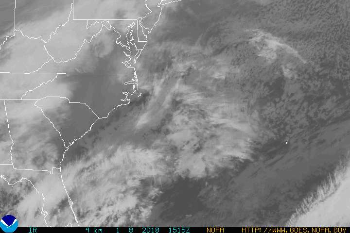
51. Post #17 shows current satellite imagery from noaa.com
And the storm seems headed to Eastern Florida at the current time.
Printer Friendly | Permalink |  | Top
 
redsoxliberal Donating Member (1000+ posts) Send PM | Profile | Ignore Tue Sep-06-05 02:04 PM
Response to Reply #51
68. that's obvious... the question is where next?
Printer Friendly | Permalink |  | Top
 
DemocratSinceBirth Donating Member (1000+ posts) Send PM | Profile | Ignore Tue Sep-06-05 01:53 PM
Response to Reply #46
54. Two Small Points.....
I hope you aren't hoping for a hurricane to vindicate your prediction....

And I'll bet $500.00 to the Katrina relief fund of your choice that Tropical Depression Sixteen won't get anyhwhere near New Orleans...
Printer Friendly | Permalink |  | Top
 
redsoxliberal Donating Member (1000+ posts) Send PM | Profile | Ignore Tue Sep-06-05 02:02 PM
Response to Reply #54
64. won't do either
Printer Friendly | Permalink |  | Top
 
txaslftist Donating Member (1000+ posts) Send PM | Profile | Ignore Tue Sep-06-05 01:58 PM
Response to Original message
59. Dang. Who knew there were so many meteorologists on DU?
Printer Friendly | Permalink |  | Top
 
WilliamPitt Donating Member (1000+ posts) Send PM | Profile | Ignore Tue Sep-06-05 02:01 PM
Response to Reply #59
63. This thread is a goddam riot
Printer Friendly | Permalink |  | Top
 
Tesibria Donating Member (1000+ posts) Send PM | Profile | Ignore Tue Sep-06-05 02:02 PM
Response to Reply #63
65. true true ... sometimes, just can't help ourselves .... nt
Printer Friendly | Permalink |  | Top
 
Rabrrrrrr Donating Member (1000+ posts) Send PM | Profile | Ignore Tue Sep-06-05 02:54 PM
Response to Reply #63
72. I love flame wars over meteorological models
it's so deliciously geeky!
Printer Friendly | Permalink |  | Top
 
IdaBriggs Donating Member (1000+ posts) Send PM | Profile | Ignore Tue Sep-06-05 03:30 PM
Response to Reply #72
79. I have no idea what they are talking about, but it is so -- CUTE! nt
(giggle)
Printer Friendly | Permalink |  | Top
 
Freddie Stubbs Donating Member (1000+ posts) Send PM | Profile | Ignore Tue Sep-06-05 03:28 PM
Response to Original message
77. Which models?
Do you have a link?
Printer Friendly | Permalink |  | Top
 
redsoxliberal Donating Member (1000+ posts) Send PM | Profile | Ignore Tue Sep-06-05 03:50 PM
Response to Reply #77
81. ECMWF, GFDL, some computer models, one of the BAM suite
as of 12z, that is... haven't had a chance to look at 18z yet, but will do now.
Printer Friendly | Permalink |  | Top
 
tkmorris Donating Member (1000+ posts) Send PM | Profile | Ignore Tue Sep-06-05 04:57 PM
Response to Reply #81
83. Here's an objective view of the ECMWF
ECMWF

"Compared to the other 2 operational models described above, the ECMWF does the best in predicting mid/upper tropospheric heights during the colder part of the year(such as October through April). The ECMWF tends to perform quite well in predicting amplitudes of planetary-scale regimes such as the Pacific/North American teleconnection (PNA). This model can also perform outstandingly during low to high planetary-scale wavenumber transition events, and northern hemispheric-scale regime transitions (Berry et al. 1996, CR TM 111).
Outperforms the other medium-range forecast models during shallow cold air situations.
Tends to overdevelop mid/upper cyclones across the southwestern U.S. Situations arise where this model will be too slow to predict the movement of cyclones from the southwest deserts.
Has a slight tendency to forecast mid/upper tropospheric heights and the resultant thickness calculations too high (i.e.; a warm bias).
Sometimes, especially during the warmer portion of the annual cycle, this model has too many closed lows. This bias may be related to its high resolution.
Tends to overamplify the long wave pattern, resulting in slower than observed progression of systems through the westerlies. This can result in overly weak and northward displaced short waves and associated surface features lifting into the long wave ridge position.
Found to have the smallest overall distance errors with springtime closed low forecasts during days four and five.
Westward forecast bias of closed cyclones (related to the issue described above)
Often too slow moving short wave features in deamplifying or zonal patterns
Of the medium range models, the ECMWF performs best with driving Arctic fronts down the east slopes of the Rockies.
The ECMWF too often incorrectly digs closed upper lows SWWD then WWD underneath strong upper ridges over the Eastern Pacific."


Like any model, it does well with some things and piss poor with others. Calling it "the best model in the world" is just nonsense. By the way, you're on the storm2k boards aren't ya? There's a guy over who sounds a lot like you. The pro mets are handing him his ass.

Printer Friendly | Permalink |  | Top
 
redsoxliberal Donating Member (1000+ posts) Send PM | Profile | Ignore Tue Sep-06-05 10:25 PM
Response to Reply #83
84. no, only eastern and occasionally WW in the winter
by the way, have you seen that the TD is not moving NW as progged, but rather W?

If you read my post, I said it was unlikely to strike NOLA... but it WILL enter the gulf. It will NOT go to Georgia and then recurve.

And, if you were to ask anyone who knows weather forecasting well what the best model in the world is (aside from SREF and ETA/NAM within 36-48 hrs or so, we are currently talking 5-7 days) they will overwhelmingly say the ECMWF.
Printer Friendly | Permalink |  | Top
 
DU AdBot (1000+ posts) Click to send private message to this author Click to view 
this author's profile Click to add 
this author to your buddy list Click to add 
this author to your Ignore list Tue Apr 30th 2024, 04:49 PM
Response to Original message
Advertisements [?]
 Top

Home » Discuss » Archives » General Discussion (Through 2005) Donate to DU

Powered by DCForum+ Version 1.1 Copyright 1997-2002 DCScripts.com
Software has been extensively modified by the DU administrators


Important Notices: By participating on this discussion board, visitors agree to abide by the rules outlined on our Rules page. Messages posted on the Democratic Underground Discussion Forums are the opinions of the individuals who post them, and do not necessarily represent the opinions of Democratic Underground, LLC.

Home  |  Discussion Forums  |  Journals |  Store  |  Donate

About DU  |  Contact Us  |  Privacy Policy

Got a message for Democratic Underground? Click here to send us a message.

© 2001 - 2011 Democratic Underground, LLC