Now I'm not sure where that blue patch actually is... need to view a closer map
If the grapevine, then it's normal
edit: yep, that's what it is:
http://www.weatherunderground.com/cgi-bin/findweather/getForecast?query=frazier+park%2C+ca#SPEStatement as of 5:25 PM PST on January 23, 2008
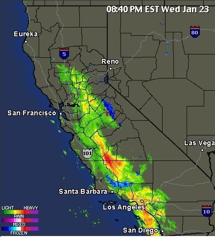
... Locally heavy snow in the Diablo Range in Fresno County and in
the western Tehachapi Mountains...
An upper level low west of Monterey Bay continues to spin a band
of rain and mountain snow from the Grapevine north over the west
side of the San Joaquin Valley. This band of precipitation has
produced over a foot of snow at Frazier Park... and snow has closed
the Grapevine. Further north... locally heavy snow has fallen as
low as 2500 feet in the Diablo Range near Coalinga... closing
Highway 198 over the Diablo Range.
Snow will be possible elsewhere in the temblors and the Diablo
Range from Kern County north into Fresno County. Other mountain
roads in the temblors and the Diablo Range above 2500 feet also
may be impacted by the snow.
Drivers heading into the temblors and the Diablo Range should
exercise caution... and be prepared for possible Road closures.