| Latest | Greatest | Lobby | Journals | Search | Options | Help | Login |
|
|
|
| Home » Discuss » Places » Kansas |
|
| Mabus
|
Sun Mar-12-06 01:24 PM Original message |
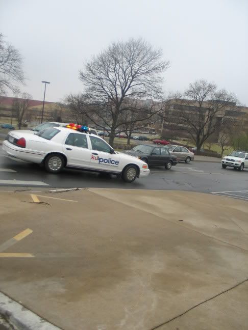
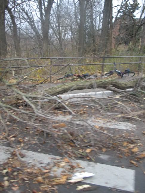
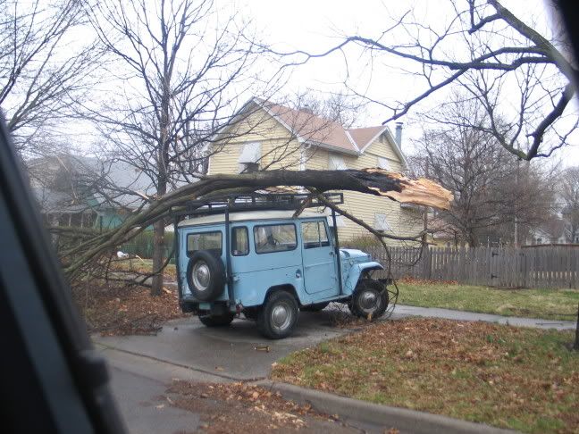
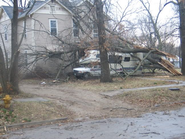
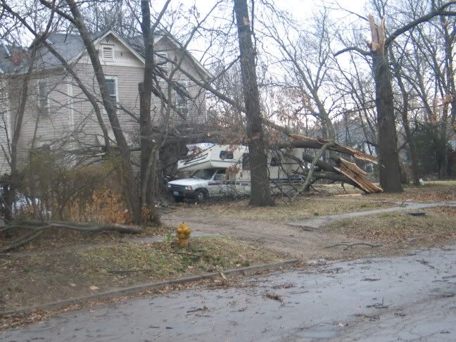
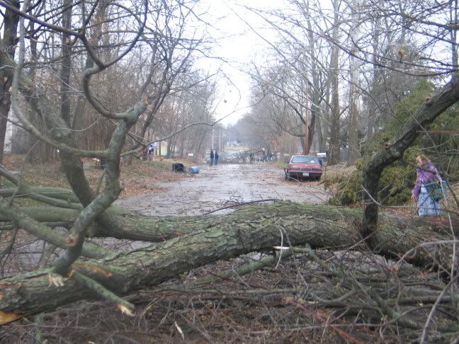
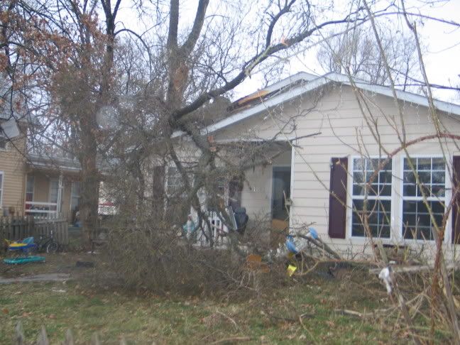
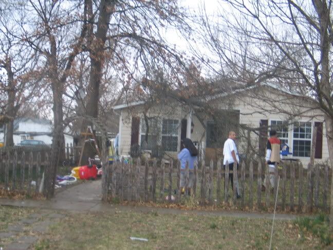
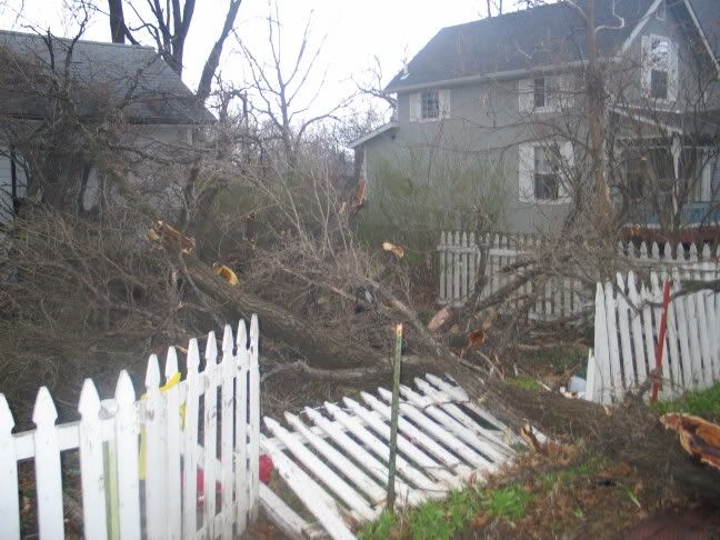
| Pictures of damage in Lawrence (microburst? tornado?) -lots of pictures |
| Refresh | 0 Recommendations | Printer Friendly | Permalink | Reply | Top |
| Mabus
|
Sun Mar-12-06 02:03 PM Response to Original message |
| 1. More pictures on LJWorld website |
| Printer Friendly | Permalink | Reply | Top |
| MuseRider
|
Sun Mar-12-06 02:38 PM Response to Reply #1 |
| 2. Is your house OK? |
| Printer Friendly | Permalink | Reply | Top |
| Mabus
|
Sun Mar-12-06 02:53 PM Response to Reply #2 |
| 3. Our house is fine |
| Printer Friendly | Permalink | Reply | Top |
| alfredo
|
Mon Mar-13-06 07:22 PM Response to Original message |
| 4. tornadoes are strange creatures. They can mow down everything in |
| Printer Friendly | Permalink | Reply | Top |
| Mabus
|
Tue Mar-14-06 01:30 AM Response to Reply #4 |
| 5. Around here we know what tornados can do |
| Printer Friendly | Permalink | Reply | Top |
| alfredo
|
Tue Mar-14-06 01:54 PM Response to Reply #5 |
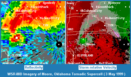
| 6. I remember seeing a weather map showing a huge super cell |
| Printer Friendly | Permalink | Reply | Top |
| Mabus
|
Wed Mar-15-06 12:48 AM Response to Reply #6 |
| 7. On the doppler |
| Printer Friendly | Permalink | Reply | Top |
| alfredo
|
Wed Mar-15-06 01:40 AM Response to Reply #7 |
| 8. I've seen the "hook" many times. I have a Dashboard doppler radar |
| Printer Friendly | Permalink | Reply | Top |
| DU
AdBot (1000+ posts) |
Thu May 02nd 2024, 12:46 AM Response to Original message |
| Advertisements [?] |
| Top |
| Home » Discuss » Places » Kansas |
|
Powered by DCForum+ Version 1.1 Copyright 1997-2002 DCScripts.com
Software has been extensively modified by the DU administrators
Important Notices: By participating on this discussion board, visitors agree to abide by the rules outlined on our Rules page. Messages posted on the Democratic Underground Discussion Forums are the opinions of the individuals who post them, and do not necessarily represent the opinions of Democratic Underground, LLC.
Home | Discussion Forums | Journals | Store | Donate
About DU | Contact Us | Privacy Policy
Got a message for Democratic Underground? Click here to send us a message.
© 2001 - 2011 Democratic Underground, LLC