Last Saturday, I had the chance to get down to central Oregon, for a shoot at a location that I'd been wanting to visit for several years: the Proxy Falls Trail. Was the experience worth it? To be honest, I still haven't decided...and that's why this is the first WFOT installment with a poll attached, just as its the first one with far more words than pictures.
To begin with, this is as far afield as I've traveled on a photo "day-trip" -- approximately six to seven hours each way. Normally, the farthest I'll travel is about four-and-a-half hours away, and I really wasn't prepared for the road time. At other times, I might have considered making this an overnighter; but, needing to be home for Father's Day, that wasn't an option. And, since this might have been the last June weekend day with overcast in the forecast (June being supposedly the best month for shooting this fall) I figured it was "now or never."
Proxy Falls Trail is laid out as a loop, and every guidebook I've seen recommends hiking it in a clockwise direction, it being shorter and easier to get to both of the two falls, at which point you can decide to backtrack instead of completing the longer part of the loop. Upon arriving, I found out that this was not an option, due to a "house-sized log" blocking the desired trailhead. The only choice was to go counterclockwise and then return the way I'd come, meaning a longer and harder hike. It was at that point that I discovered the second "inconvenient truth" about shooting Proxy Falls; that, even though the
El Ni�o year meant a mild winter for Washington, apparently the same was not the case for the Oregon Cascades. Not only were water levels running unusually high, but the rhododendrons (normally one of the main reasons for shooting this location in June) had not yet begun to bloom. Had I known both of these situations, I would have waited and prayed for an overcast weekend day sometime in mid-July.
In any event, I made it up the trail, past the spur to Proxy itself, to the first (and smallest) waterfall,
Upper Proxy Falls (sometimes just known as
Upper Falls).
If the angles on this fall seemed somewhat obscured, it's because the normal fifteen-foot-diameter plunge-pool at its base was more like thirty-five or forty feet (see "water levels running unusually high," above), meaning that the ideal tripod position would have been in a foot or two of water. Since I didn't know this would be the case, I didn't bring my waders along on this hike, and so had to be content with trying to find a set of tripod holes on a steep slope going down to the pool; even the "best" views of Upper Proxy were blocked by something or other...
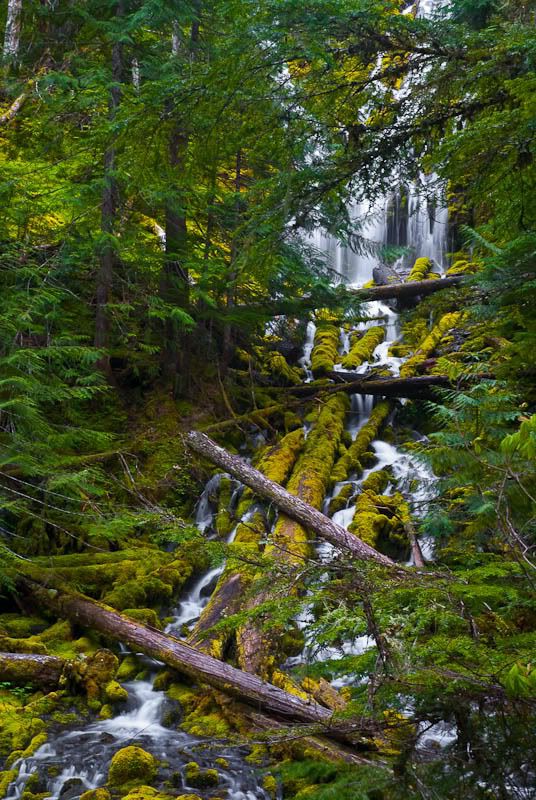
...and so, in the end, the best I could do was to shoot the rapids at the very bottom of the fall.
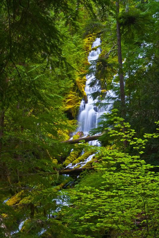
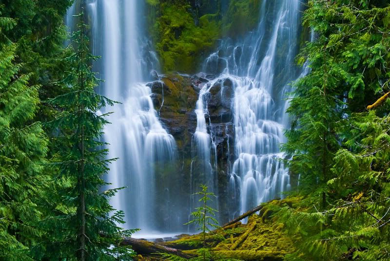
Leaving Upper Proxy behind, I moved on to the "main attraction,"
Proxy Falls, renowned as one of the most photogenic waterfalls in the country.
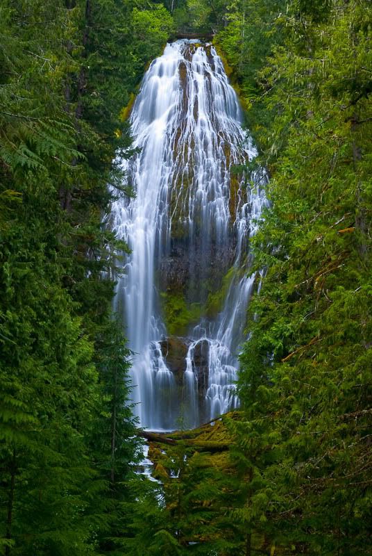
The picture above doesn't begin to do it justice, simply because you can't really convey scale in an 800-pixel-tall image; imagine a fall 250 feet high, with the water breaking into dozens of mini-trails over moss-covered rock, then dropping through an undercut onto a series of basalt "steps" somewhat resembling Giant's Causeway in Northern Ireland. As you look at the photo, also imagine a sense of the water constantly in motion on its multitude of passages, instead of being frozen in time by the camera's shutter. I wish I could find a way to convey it; "breathtaking" doesn't come close to an accurate description.
Still, as impressive as that was, I was well aware that the best photos I've seen of Proxy Falls haven't been from the upper viewpoint, but up-close-and-personal ones from the riverbed directly below the falls. Accordingly, after taking a bunch of "record shots" from the viewpoint, I packed up my equipment and started to follow the trail down to the base of the falls.
And, then, I discovered the
third "inconvenient truth" --
there is no trail down to the base of the falls. The trail basically stops just past the viewpoint, and it is up to the visitor to figure out a route down a steep, slippery slope to the river's edge a hundred or so feet down -- and, just as importantly, a route back up again. (This is where I air my gripe about the many guidebooks that describe the hike to Proxy Falls as "easy" -- re-reading them, I realize that what they're referring to is the hike to the upper viewpoint,
not to the base of the falls. In retrospect, it also explains why so many of those "best photos I've seen" turn out to be the work of only a handful of photographers -- those young and agile enough to make it down to the best vantage points.)
After making a couple of attempts on my own, each ending when I found myself hanging onto a tree, realizing that the next step might cause irreparable damage to either my bones or, worse, my equipment. Finally, I went back to the upper viewpoint and asked if anyone there had experience getting down to the base. As it turned out, the only ones I found were a couple of young kids with a rather expensive Nikon, who proceeded to show me their route -- unfortunately, although it looked easier than the ones I tried, it was blocked by a fallen tree-trunk which was quite easy for young kids to duck under, but thoroughly impossible for a less-than-agile fifty-something like myself. (In any event, the same two kids returned a few minutes later, reporting that the aforementioned high water meant extremely slippery conditions at the base of the falls, plus enough spray to make photography down there pointless.)
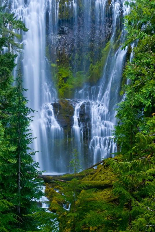
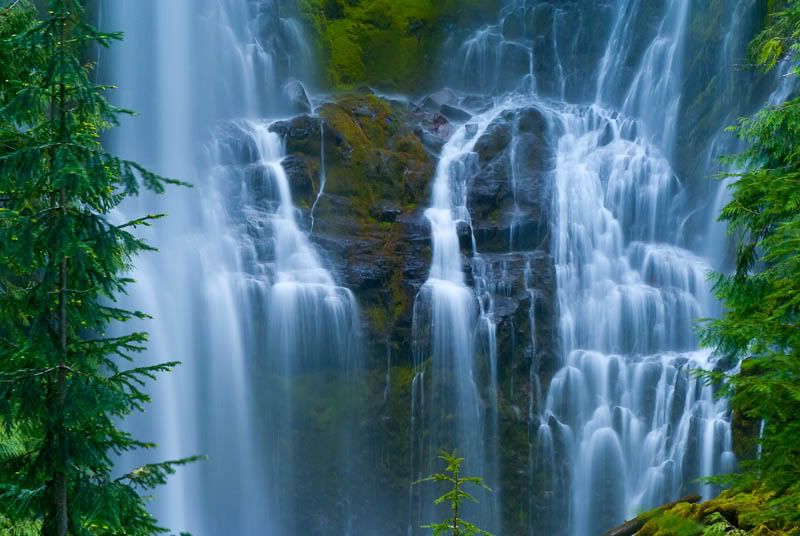
So, with no other option available, all I could do was return to the upper viewpoint, break out the telephoto, and try to get "close-up" shots from a distance. (For obvious reasons, the resulting images will be at the bottom of the post, near the poll question.)
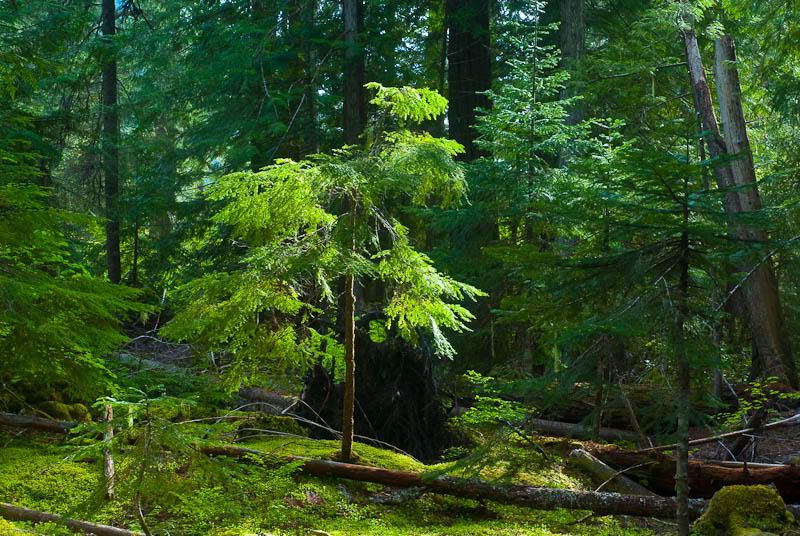
Meanwhile, on the way back to the road, the trail took me through a forest glade just as the sun illuminated the small tree at its center...
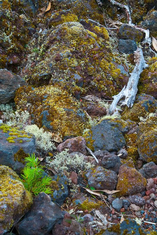
...and, afterward, through a lava-flow from an extinct volcano, with new growth emerging from the volcanic rocks and remains of older growth providing a sobering reminder of what is often the fate of living things trying to gain a toehold among the stones.
So, finally, we get to the shots I mentioned, the "plan B" attempts to capture Proxy Falls via long lenses, all taken from more-or-less the same vantage point, with different focal lengths and orientations. Keep in mind that these look nothing like the images I had long hoped to find at Proxy, based on other photos of the falls I've been seeing for years. Because of the length of the drive, I doubt I'll be returning here again, so these are probably the only images I'll ever take of this location. Did I waste my time?
So, please be (brutally) honest:
Was this trip worth it?