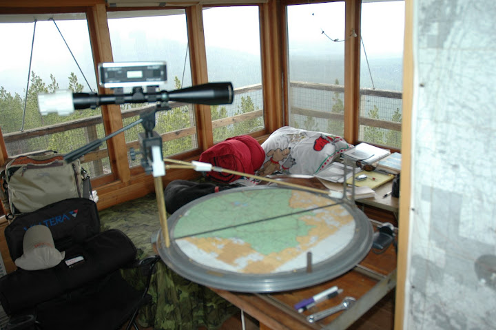
Has Mac gone math mad? Perhaps. Remember the new vertical deviation scope that my boss brought out a couple of days ago .. the Bushnell with a Spi-Tronics digital level? Well, taxpayer, today you payed me to register elevations on known landmarks (Plot Butte, Mahogany Butte, Antelope Butte, Double-Vision Butte (my naming .. I'll explain later), No Name Butte 1, No Name Butte 2 (they will have names by the end of the week!)). I entered the known distance in as Y, and the found angle in as X, with N=12.
Now I can enter found angles (X) and solve for distance (Y) to the nearest .05 statute mile! It works well in my sectors from about NNW through SSW. I'll do 30-degree pie-shaped wedges for the western area of operations (AO), where there is a pronounced upslope to the Newberry Caldera. When I fine tune it, it will be a poor-man's DragonPlot for my AO. With my derived distance, and known azimuth, I'll be able to plot a "smoke" to the Township/Range/Section and quarter of the quarter section with far greater accuracy (lacking the $2500/yr DragonPlot program in this lookout .. two in our district have DragonPlot, and if they are not busy I can always call in my range and elevation for a DragonPlot solution from my LAT/LON).
Daddy says it all sounds like artillery spotting and registration from the hilltops in Italy in WW-II. An ex-marine (Viet Nam, Rock Pile, Arty FO), visiting the tower a couple of days ago said the same thing). Right twenty, drop twenty, FIRE FOR EFFECT!"
OK, as the sun sinks over the Newberry Caldera, I'll explain Double-Vision Butte. It ain't likker in the lookout. Plot Butte, almost due east, has Antelope Butte a mile behind it. Antelope Butte is slightly higher. They both have the same wavy undulations to their profiles. Under almost all daylight conditions (save an hour or so in late afternoon), I have to close one eye when I look at Plot/Antelope .. aka "Double Vision Butte.