General Discussion
Related: Editorials & Other Articles, Issue Forums, Alliance Forums, Region ForumsTropical Storm Watch for Jamaica --- Isaac not following the forecast?
At 5:30 a.m. (CDT) the government of Jamaica issued a Tropical Storm Watch for the island.
According to the the 7 a.m. (CDT) bulletin from the National Hurricane Center, Isaac has strengthed to 50 mph and is moving past the southern coast of the Dominican Republic. It is currently centered 220 miles Southeast of Port Au Prince, Haiti, and still moving west.
If Isaac continues to jog west and miss the treacherous mountains of Haiti and Cuba (as the Tropical Storm Watch at Jamaica may suggest) and a Tropical Storm Watch is issued for the Cayman Islands, then Isaac might start aiming for the Yucatan Channel and the very warm waters of the Gulf of Mexico. Or it could also mean Isaac has it eye on Central America.
http://www.nhc.noaa.gov/text/refresh/MIATCPAT4+shtml/240848.shtml
 = new reply since forum marked as read
Highlight:
NoneDon't highlight anything
5 newestHighlight 5 most recent replies
= new reply since forum marked as read
Highlight:
NoneDon't highlight anything
5 newestHighlight 5 most recent replies

malaise
(269,157 posts)and Isaac sure looks like a threat to us come tomorrow. The good news is that it is only 50mph - the bad news is the amount of rain coming,.

ananda
(28,876 posts)Not good.
Baclava
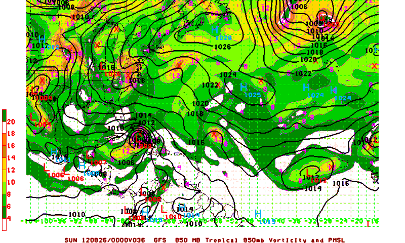
(12,047 posts)latest GFS model run...
HopeHoops
(47,675 posts)ananda
(28,876 posts)JayhawkSD
(3,163 posts)but not by anything close to what you are suggesting. Central America?
Original track had it right on the west coast of the Florida penninsula. Currently it is forecast to make landfall near Alabama Mississippi border. The discussion is that it may bend slightly eastward again as it heads north.
The strength of a tropical storm is determined by many things other than surface water temperature, and even with it's present predicted track over open water, Issac is predicted to be barely into Cat 1 when it makes landfall. The concern for Haiti is rainfall, which could be disasterous, since some 400,000 people still live in tents.
Baclava
(12,047 posts)Isaac has no defined eyewall yet, and it's going to get bounced around and torn up by Cuba and the other islands, it's still a bit of a mess to figure out
 ?989442212

Hugabear
(10,340 posts)

Berlum
(7,044 posts)

cbdo2007
(9,213 posts)hahahaha