How the Greeks Got There
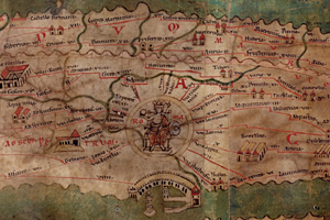
Around 450 BC, Hanno, the King of Carthage, led a fleet of sixty ships on a colonizing expedition down the west coast of Africa. Along the way he kept a log, recording the locations of the colonies he founded and the sights he saw: a race of men called the Troglodytae, said to run faster than horses; “a country burning with fire and perfume;” a towering volcano called the Chariot of the Gods. This type of log was called a periplus, an ancient wayfinding document that listed the ports of call and natural landmarks navigators could expect to find when sailing from one location to another. According to the exhibit “Measuring and Mapping Space: Geographic Knowledge in Greco-Roman Antiquity,” these texts, which often incorporated literary description and even myth (many, for instance, have debated the veracity of Hanno’s periplus), were among the preferred means of navigating for ancient mariners.
http://www.nybooks.com/blogs/gallery/2013/dec/04/ancient-maps-how-greeks-got-there/
 = new reply since forum marked as read