Black Summer Imaging: 72,000 sm Of Australia Burned In Last 12 Months; Here's The View From Space
Last edited Tue Sep 1, 2020, 09:47 AM - Edit history (1)
There is no doubt that Australia's Black Summer last year was absolutely devastating. Fires across the country burnt through 186,000 square kilometres (72,000 square miles) of land, killing 34 people, while billions of animals were affected. But there's something particularly chilling about seeing the end results of the blaze.
Australian aerial analysis company Geospatial Intelligence has worked with the New South Wales (NSW) government to capture before and after images of the state, and the pictures are devastating.
Large areas that once contributed to the green and thriving regions around Australia's extreme, hot interiors now look barren.
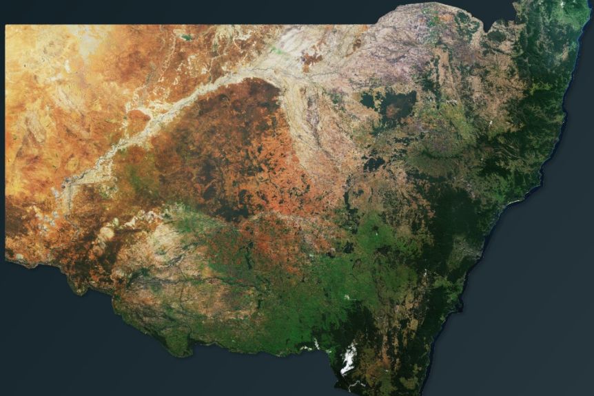
NSW before the 2019/20 fire season. (Geospatial Intelligence)
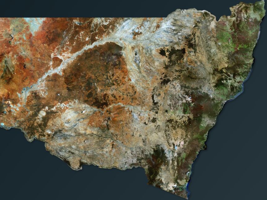
NSW after the 2019/20 fire season. (Geospatial Intelligence)
The images were taken during 2019, before the bushfire season, with a second set then taken immediately after the bushfires in early 2020. Although the photos are heartbreaking, they do give governments important information about the landscape, giving data about fire scars, vegetation levels, as well as property and infrastructure damage.
EDIT
https://www.sciencealert.com/satellite-images-compare-before-and-after-australia-s-horrific-bushfire-season
 = new reply since forum marked as read